
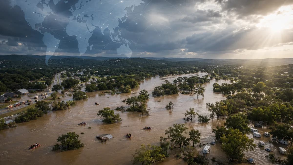
At least one person has died as Texas floods again hit the same Guadalupe River region where more than 130 people were killed last summer, turning a fresh emergency into a test of whether last year’s disaster changed enough on the ground.
XOOMAR Intelligence
Analyst Take
The current flooding across central Texas has triggered evacuations, water rescues, and urgent warnings from forecasters, according to BBC World. The location matters. Last year’s flash floods also originated from the Guadalupe River, and the dead included 25 children and two counsellors at Camp Mystic, an all-girls camp near Kerrville, Texas.
XOOMAR analysis: the core issue isn’t just that another storm hit. It’s that the same river corridor has again produced conditions fast enough to overwhelm normal decision-making. When water rises by feet per hour, evacuation plans, alert systems, road closures, and human reaction time all get stress-tested at once.
Texas Hill Country is reliving a flood disaster that should have changed the playbook
The current confirmed toll is lower than last year’s, but the pattern is grimly familiar. Texas Governor Greg Abbott said Thursday that at least one person had died and about 80 rescues had been made. He also said the person killed was not a camper in the region.
“We will be doing everything possible to save human life,” Abbott said in an update posted to social media.
That statement captures the immediate priority. The harder question comes after the water falls: did the region absorb the lessons from a flood that killed more than 130 people last summer?
The National Weather Service in San Antonio warned that the threat was active and severe:
“CATASTROPHIC flooding is occurring. Move to higher ground now! Guadalupe River is rapidly rising and will continue!”
The warning language is unusually blunt because the danger is unusually compressed. In flash flooding, the window between “concerning” and “deadly” can be short. Last year at Camp Mystic, the Guadalupe River rose 26ft in about 45 minutes, according to the BBC report. That is not a planning detail. It is the whole problem.
The numbers behind the Texas floods: deaths, rainfall, rivers, and exposed places
The verified numbers show why these Texas floods are not a routine high-water event.
| Measure | Reported detail |
|---|---|
| Current death toll | At least one person dead |
| Current rescues | About 80 rescues, according to Abbott |
| Last year’s toll | More than 130 deaths |
| Camp Mystic deaths | 25 children and two counsellors |
| Guadalupe rise this week | 32ft (975cm) in a four-hour span, according to the Texas Tribune via BBC |
| Rainfall | Up to 20in in parts of the region, according to The Guardian |
| Affected counties | Uvalde, Kerr and Kendall, according to BBC |
The source reports point to several risk signals: fast river rises, prolonged rain, low-water crossings, and people trapped in homes, vehicles, trees, and rooftops. The Guardian reported flash flood emergencies for parts of Kerr and Uvalde counties and the broader Texas Hill Country, with emergency crews conducting water rescues.
This follows a wider pattern of dangerous South Texas flooding we tracked in 16 Inches Swamp Roads as South Texas Flooding Spreads, where road access and flood depth became central safety issues.
XOOMAR analysis: the verified record supports one clear conclusion. The danger concentrates where people, roads, camps, and gathering places sit close to rivers that can rise violently. The source material names camps and a dance hall, including floodwaters engulfing the Rodeo Los Corrales Dance Hall in Comfort, Texas. It does not provide enough evidence to generalize about every type of riverside property in the area.
The Guadalupe River turns warning time into the scarcest resource
The supplied reports do not establish detailed geology as the cause of this event. They do establish speed.
That speed is what makes the Guadalupe River corridor so dangerous. A river rise of 32ft in four hours, or last year’s 26ft surge in about 45 minutes at Camp Mystic, leaves little margin for hesitation. A resident checking a road, a driver approaching a low-water crossing, or staff trying to move a group can lose safe options quickly.
The camper deaths from last year should be understood through exposure, not spectacle. Camps place children, counsellors, and visitors near rivers for recreation and lodging. When an overnight flood arrives, people may be asleep, unfamiliar with local routes, or dependent on adults and vehicles to move as a group.
That creates operational risk:
- Alerts: Warnings must reach people who may be sleeping or away from phones.
- Routes: Evacuation paths can fail if roads flood before people leave.
- Groups: Moving children or visitors takes longer than moving a household.
- Roads: Low-water crossings can turn a wrong call into a rescue within minutes.
Abbott said the “rapidly rising rivers” would continue to rise throughout the day. That matters because a flood emergency is not finished when the first wave passes. New rain, upstream flow, and blocked roads can keep people exposed after the initial warning.
Emergency alerts now face a credibility test in the same counties
The National Weather Service used severe language. Abbott reported rescues. Local emergency officials encouraged evacuations early Thursday morning. Those are meaningful actions.
The test is whether warnings translated into timely movement.
Technology helps, but it cannot do the hard part by itself. Phone alerts, radar, river gauges, social posts, and official warnings can identify danger. They cannot guarantee that a family knows the safest route, that a camper can be moved before roads close, or that a driver will avoid flooded pavement.
The Guardian reported that more than 1,300 responders had been deployed, while CNN reported multiple water rescues and said another wave of heavy rain was possible overnight into Friday. That level of response shows capacity. It also shows strain.
XOOMAR analysis: after last year’s 130-plus deaths, public messaging will be judged by outcomes as much as wording. If warnings arrived early and people moved, that supports the case that systems improved. If rescues concentrated around known danger points, the pressure shifts to evacuation planning, road closure timing, and site-level emergency rules.
Public safety failures can become accountability stories long after the immediate disaster, as our coverage of 43 Deaths Land Genoa Bridge Disaster Boss 12 Years showed in a different context. Floods are different from bridge collapses, but the post-disaster question is similar: who knew the risk, and what changed after the warning signs?
Families, rescuers, camp operators, and officials are looking at different crises
For families, the question is personal and direct: were people told to leave soon enough, and did they know where to go?
For first responders, the crisis is physical. Rescue crews enter moving water, debris, blocked roads, and unstable conditions after earlier decisions have already narrowed the options. The reports of stranded people in homes, vehicles, trees, and rooftops show how quickly a weather event becomes a rescue operation.
For local officials, the problem is coordination across counties, roads, rivers, and agencies. The BBC named impacts in Uvalde, Kerr and Kendall counties. The Guardian also cited warnings across other nearby areas. Floodwater does not respect jurisdictional lines.
For camp operators and riverside venues, last year’s tragedy at Camp Mystic is impossible to ignore. The camp decided not to reopen this year and filed for bankruptcy earlier this summer, according to BBC. That is a stark signal of how a flood can destroy not only lives, but the viability of an institution tied to a river location.
XOOMAR analysis: insurance, lending, and property risk questions are likely to follow if repeat flooding continues, but the supplied sources do not report premium changes, coverage withdrawals, or lender action. Those are watch items, not established facts.
Repeated Texas floods are turning known river risk into a planning test
The practical lesson from these Texas floods is narrow but important: historical familiarity with a river does not make a fast-rising river manageable.
Communities in flood-prone areas should watch four evidence points after this event:
- Crests: Final river gauge data will show how this flood compares with last year’s disaster.
- Casualties: Updated death and injury figures will define the true human cost.
- Rescues: Locations of rescues will reveal whether known roadways, crossings, or sites failed again.
- Warnings: Timelines will show whether alerts came early enough to change outcomes.
If the evidence shows accurate warnings and fewer deaths in similarly dangerous conditions, that would support the view that emergency communication improved. If the evidence shows repeated rescues in predictable locations, the case for stricter site planning and faster evacuations becomes harder to dismiss.
Texas cannot treat repeat deadly flooding in the Guadalupe River corridor as bad luck. The region now has a record. The next serious test is whether that record changes decisions before the next storm, not after the rescues begin.
Impact Analysis
- The same Texas river corridor is flooding again after a disaster that killed more than 130 people last summer.
- Rapid river rises can overwhelm evacuation plans, alerts, road closures, and rescue operations at the same time.
- The response will test whether local and state officials improved preparedness after the Camp Mystic tragedy.
Current Texas Flooding vs. Last Summer's Guadalupe River Disaster
| Factor | Current Flooding | Last Summer's Flooding |
|---|---|---|
| Location | Central Texas, Guadalupe River region | Guadalupe River region near Kerrville, Texas |
| Deaths | At least 1 confirmed | More than 130 killed |
| Children killed | Not reported | 25 children killed |
| Camp impact | Fatality was not a camper | Camp Mystic lost 25 children and two counsellors |
| Emergency response | Evacuations, water rescues, urgent warnings; about 80 rescues reported | Disaster prompted questions about flood preparedness and alerts |
Reported Human Toll in Guadalupe River Flooding
Primary Sources & Disclosures

Written by
XOOMAR Insights Team
Research and Editorial Desk
The XOOMAR Insights Team pairs automated research with human editorial judgment. We track hundreds of sources across technology, fintech, trading, SaaS, and cybersecurity, cross-check the facts, and explain what happened, why it matters, and what to watch next. We do not just rewrite headlines. Every article is fact-checked and scored for reliability before it goes live, and we link back to the original sources so you can verify anything yourself.