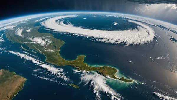

Tropical Storm Bertha pushed the Gulf Coast threat into Texas on Thursday after striking Louisiana a day earlier, with forecasters warning that coastal flooding, heavy rain and dangerous surf could outlast the storm’s center.
XOOMAR Intelligence
Analyst Take
Bertha made landfall in Louisiana on Wednesday afternoon and moved west toward the upper Texas coast, according to Guardian World. Later Thursday, other weather updates said the storm made another Gulf Coast landfall near the Texas-Louisiana border before weakening inland.
Tropical Storm Bertha shifts the main danger from Louisiana to Texas
The US National Hurricane Center said Thursday morning that Bertha was moving west and that its center was expected to move near or along the Louisiana and upper Texas coasts before moving inland over Texas on Thursday evening.
At that point, maximum sustained winds remained near 45mph (75km/h), with higher gusts. Forecasters expected Bertha to hold tropical storm strength until it reached the upper Texas coast, then dissipate inland over Texas late Thursday night or Friday.
The working question for coastal residents was simple: would Bertha’s strongest impacts arrive with the center, or ahead of it?
The answer, based on the warnings, was water first. Tropical storm warnings were in effect Thursday morning from Morgan City, Louisiana, to Sargent, Texas, while the warning east of Morgan City had been discontinued.
ABC News later reported that Bertha made a second landfall Thursday afternoon near Lake Charles, Louisiana, close to the Texas-Louisiana state line, and continued west across Texas. AccuWeather reported that Bertha weakened to a tropical depression Thursday evening near Houston, with maximum sustained winds down to 35 mph.
“This rainfall may produce isolated flash flooding, especially in urban areas,” the NHC said.
For readers following Texas public safety pressures beyond the storm, XOOMAR has also covered the state’s broader crisis response environment, including Texas Migrant Deaths Indictment Unmasks Rail Horror and Rape Accusation Imperils Blake Miguez Trump Endorsement.
Low-lying Gulf communities face water first, wind second
The most immediate risk from Tropical Storm Bertha was not just wind along the coast. It was rising water pushed inland by storm surge, tide and persistent onshore flow.
A coastal flood warning was in effect Thursday morning for Lower St Mary parish, Louisiana, where forecasters warned that 2ft to 3ft of “inundation is expected along the coast” and that “low lying property including homes, businesses, and some critical infrastructure will be inundated.”
The NHC described the mechanism directly:
The combination of storm surge and the tide was expected to cause “normally dry areas near the immediate coast to be flooded by rising waters moving inland from the shoreline”.
That matters because flooding can arrive before a storm’s center crosses a specific town. In Louisiana, the Guardian source described water being pushed into streets in Venetian Isles just after the morning high tide on Wednesday, as winds from Bertha affected the area.
Which communities had the least margin for error? The source points to low-lying coastal areas first, especially where water levels were already rising and where roads, homes, businesses and infrastructure sit close to the shoreline.
The NHC also warned that Bertha could produce 2 to 4 inches of total rainfall, with isolated totals up to 6 inches through Thursday night along the Texas Gulf Coast and South Texas. That is the flood risk that follows the storm inland.
| Area | Main hazard cited by forecasters | Specific source detail |
|---|---|---|
| Lower St Mary parish, Louisiana | Coastal flooding | 2ft to 3ft of inundation expected |
| Texas Gulf Coast and South Texas | Heavy rain and flash flooding | 2 to 4 inches, isolated 6 inches |
| Northern and northwestern Gulf Coast | Surf and rip currents | Swells likely to cause life-threatening conditions |
| Houston/Galveston coastal counties | Gusty winds | Gusts up to 40mph most likely along immediate coast |
The National Weather Service in Houston/Galveston said Thursday that Bertha was moving westward with “maximum sustained wind speeds of 45mph” in some coastal counties, while “gusts to weak tropical storm force (up to 40mph) are the most likely impact along the immediate coast.”
Further inland, the office said some 20-30mph gusts could be anticipated as the day progressed.
Texas emergency managers now track inland rain, not just landfall
By Thursday evening, the storm track had shifted the main concern inland. AccuWeather reported that Bertha weakened to a tropical depression near Houston, and later said Bertha degenerated late Thursday night while lingering tropical moisture continued to pose a heavy rain risk.
The key question now is which hazard lingers longest after the coastal warnings fade?
Based on the supplied forecasts, the answer is rainfall and localized flooding. The NHC’s rainfall outlook for the Texas Gulf Coast and South Texas remained the clearest inland risk signal, especially in urban areas where heavy rain can overwhelm drainage quickly.
AccuWeather’s lead hurricane expert Alex DaSilva said the main impacts from the storm “will continue to be locally heavy rain, gusty winds along the coast and storm surge that can cause some coastal flooding”.
Beach conditions remain part of the threat, even away from the center. The NHC said swells generated by Bertha were expected to keep “spreading westward along the northern and northwestern Gulf Coast” and were “likely to cause life-threatening surf and rip current conditions”.
For residents, the practical read is narrow but serious: follow local emergency alerts, avoid flooded roadways, and stay off beaches where officials warn of dangerous surf or rip currents. Regional storm maps can show direction, but local National Weather Service offices and emergency managers will have the alerts that matter block by block.
The next scenario to monitor is not whether Bertha keeps its name. It is whether its remaining moisture produces localized flash flooding across Texas after the coastal wind threat fades.
Impact Analysis
- Bertha’s main threat shifted from Louisiana toward Texas as the storm moved west along the Gulf Coast.
- Forecasters warned that flooding, heavy rain and dangerous surf could continue even after the storm center passed.
- Urban areas faced isolated flash-flood risk as Bertha weakened inland over Texas.
Bertha’s Gulf Coast impacts shifted west
| Area | Status | Main risks |
|---|---|---|
| Louisiana | Made landfall Wednesday; warning east of Morgan City discontinued | Coastal flooding, heavy rain, dangerous surf |
| Upper Texas coast | Expected to move inland Thursday evening after nearing or crossing the coast | Heavy rain, dangerous surf, isolated flash flooding |
| Near Houston/Texas inland | Weakened to a tropical depression Thursday evening, per AccuWeather | Flooding risk as rain moved inland |
Bertha maximum sustained winds
Primary Sources & Disclosures

Written by
XOOMAR Insights Team
Research and Editorial Desk
The XOOMAR Insights Team pairs automated research with human editorial judgment. We track hundreds of sources across technology, fintech, trading, SaaS, and cybersecurity, cross-check the facts, and explain what happened, why it matters, and what to watch next. We do not just rewrite headlines. Every article is fact-checked and scored for reliability before it goes live, and we link back to the original sources so you can verify anything yourself.